The Amazing Story of Lewis & Clark: America’s Most Famous Land Surveyors (Part I)
24 NovemberYou are given a hand compass and told to go off into this unknown territory and come back with a map and detailed drawings of the land. No GPS. No smartphone. No calls to mom. No helicopter to rescue you. It would be quite the feat! Many people today are used to the convenience and accuracy of GPS for navigation. If you drive into a new city, you likely use navigation tools to find the nearest burger place, hotel, or shopping center.
It wasn’t always like that. In fact, going into the unknown was part of this country’s early history. Somebody had to do it. That person (among others, of course) was Meriwether Lewis and William Clark when they set off West to map the unknown lands beyond the Mississippi River. This incredible history shows just how vast and expansive the United States was and is an inspiring real story of the American spirit on a tumultuous journey.
In past posts, we’ve explored the incredible technology that is changing and enhancing the work of land surveyors across the world. From drones to GPS to smart technology, mapping our world has improved through the implementation of these tools. We thought we’d go back in time to a story that had none of those technologies and surveyed over 8,000 miles with not much more than a pen, paper, and a whole lot of grit.
It Begins With the Son of a Surveyor and a Notable Name in American History
For most people, Thomas Jefferson is the name behind the Declaration of Independence and the third president of the United States of America. He is known as one of the most notable founding fathers who wrote and spoke eloquently about the role of government, led the revolutionary cause, and worked for the republic moving forward. A little unknown fact about Jefferson is that he was a son of a land surveyor and a land surveyor himself. He was exposed to the world of mapping and charting as a young boy and for a time considered pursuing this as his profession. Because of his exposure to the line of work, Jefferson understood the importance and necessity of having accurate maps and surveys of one’s country. He knew that a new nation attempting to build itself could not do without the knowledge of its own lands.
As president, Jefferson emphasized the importance of the landowner and the central role they played in building the country. All of this fueled his ambitions for discovery and exploration, as well as an understanding of what lay beyond the recent territories the country had just acquired.
The Louisiana Purchase obtained after a negotiation had added 827,000 square miles to the United States. This was a lot of unexplored territories. Jefferson was already calling for it to be surveyed. He appointed his secretary, Meriwether Lewis, a known surveyor as well, to lead the expedition. Lewis would choose his friend William Clark and together they would put together a team that would change American history and set an example for pioneers everywhere.
The Two Men That Would Spearhead the Corps of Discovery
Like many early pioneers, William Clark and Meriwether Lewis were men of their era: smart, with a drive for adventure, and a relentless spirit. Lewis went to college in his home state of Virginia and graduated in 1793, no small feat at the time. He joined the Virginia state militia and took part in putting a stop to the Whiskey Rebellion. He would go on to become captain of the U.S Army, and at the ripe age of 27, he became a personal secretary to the President of the United States, Thomas Jefferson.
William Clark joined the state militia of Kentucky when he was nineteen and would go on to serve in the regular Army. He served with his future partner Lewis and would be commanded by George Washington himself as a lieutenant of infantry.
Survey Instruments Used For the Treacherous Expedition
It might be interesting to note that Thomas Jefferson taught Lewis the basic principles of determining latitude by observing altitudes of the sun or a star with an octant. Both Lewis and Clark understood that this was not a journey to take lightly. Both prepared adequately for the journey Jefferson also sent him for formal education and once appointed to head the expedition, Lewis began studying medicine, botany, astronomy, and zoology. He would study and analyze existing maps and journals. Some of the surveying tools they had at the time included:
- Compass
- Quadrants
- Telescopes
- Sextants
- Chronometer
- Tape measure
- Thermometers
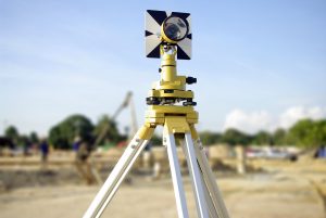
- Plotting instruments
Soon, this dynamic duo would set out for the unexplored wildlands of the West. In Part II, we’ll explore their journey, what they ran into, and what they found after miles and miles of exploration, map-making, surveying, and endless adventure.
Here at Land-Mark professional surveying, we have slightly more sophisticated equipment than Lewis and Clark, but we see every job as an adventure. For a professional land survey, contact Land-Mark today.
How Land Surveyors Shaped (and Continue to Shape) America
21 November Let’s transport ourselves to middle school history class. Do you recall the term “manifest destiny?” This was a 19th-century belief that the United States had a destiny (appointed by God) to expand across the entire North American continent. This was much more than a physical expansion of the nation; it was an expansion of the democracy and capitalism that was the foundation of the United States. Manifest destiny was much more than a belief, as it became a reality rather quickly. The Louisiana Purchase in 1803 doubled the size of the young United States, kicking manifest destiny into gear. Soon afterward, the famous Lewis and Clark expedition took place. Meriwether Lewis and William Clark were both land surveyors (amongst many other things) so they were the perfect candidates for such an expedition. This is just one example of the importance of land surveyors in America’s history.
How the Dominion of the United States Spread from East to West
The United States acquired large parts of Mexico in the early and mid 19th century. By 1846, we acquired the Oregon Territory thanks to a treaty with Great Britain. By 1850, the United States had grown to the size it is today. Fewer than 100 years after we declared independence from England, the United States ostensibly quadrupled in size. This is where land surveyors came into play. With so much land available, it was necessary for land surveyors to document each piece of the new America. Many land surveyors actually went on to become presidents of the United States. George Washington, Thomas Jefferson, and Abraham Lincoln all held the title of land surveyor. In fact, it was Thomas Jefferson who sent Lewis & Clark on their famous expedition of the Louisiana Purchase.
Land Surveyors Continue Making History
Although the days of early America are far behind us, land surveying still plays a major role in our modern society. Today, land surveyors pinpoint where your particular land begins and ends so you won’t accidentally build over someone else’s land. Surveyors are able to set boundaries as well. Many things have changed since the days of Lewis & Clark. Now, we’re able to use highly advanced technology to garner the most accurate readings. If you own land and want to begin developing it, make sure to speak with a land surveyor from Land-Mark Professional Surveying. We offer our services to clients in the Southwest regions of El Paso and New Mexico. When you partake in land surveying, you’re partaking in American history!
A Few FAQs About ALTA Land Surveys
18 May If you are buying a piece of land in Las Cruces, you have probably been asked by the bank or titling company for an ALTA survey. You may be irritated that you need to obtain such a detailed land survey, but this document provides a wealth of info about the property at hand. It may be more costly, but it is an excellent document to have to avoid issues later on down the line. We have answered a few frequently asked questions about these specific surveys here.
Why Do I Need an ALTA Survey?
This land survey is quite detailed, as mentioned before. It can be a bit more costly than the average land survey, but with reason. Title companies as well as lenders may ask for this survey. It can happen either when you are buying, selling or refinancing a property. Most often times, lenders are looking to avoid “survey risks.” This can include disputes over boundaries, encroachments and other difficult issues that can lead to problems and even lawsuits down the line. An ALTA Survey would reveal any of these issues and more. Even if the bank or titling company doesn’t require you to purchase this detailed survey, it may be advisable to avoid problems. This can be especially true when purchasing vacant land that has never been surveyed, or has been survey over a decade ago.
Why is an ALTA Survey More Costly?
Some land buyers in Las Cruces may be unhappy with the higher cost of an ALTA Survey. However, this type of survey is only performed by a registered, licensed surveyor. It means specific standards outlined by the American Land Title Association (ALTA) and the American Congress of Surveying and Mapping (ACSM). In essence, this survey meets the highest standards recognized throughout the U.S. It includes much more detail than most other land surveys. This can include boundaries, fences, utility lines, roads, easements and areas that have been improved.
How Do I Get Started With a Land Survey?
Getting started with any kind of survey in Las Cruces is as simple as calling us up at Land-Mark Professional Surveying, Inc.. We are one of the best and most reliable land surveyors in the Southwest. We provide a wealth of services to help you with your property. Whether you are buying, selling or refinancing a piece of land, our certified experts can help. Contact us today for more info.
Land Surveys in Odessa
18 April Land surveys are essential for certain circumstances. Surveying is the process of calculating and measuring specific points in relation to each other. It is used to create maps, establish boundaries and more. Land surveyors in Odessa use a wide range of tools to complete the task at hand. When you hire a firm to conduct a survey you may be baffled at the info they provide. You may even find it hard to understand some of the terminology, or even what surveying may be all about. We have a few facts here for you.
Understanding Land Survey Terms
The first thing to understand about a land survey is the fact that wide range of units of measurements can be applied. Surveying even pretty much has its own language rooted in a deep history of tradition and accuracy. The best thing you can do is speak directly with your surveyor over the questionable terms at hand. Most firms will provide a glossary for client use.
Determine Land Size and Measurements
Surveys are often used to find the exact size and measurement of a plot of land at hand. This can be useful for government use when city lines and districts are drawn. Map making is a large part of the survey industry. This can include creating road, topographical, and other types of maps. State-of-the-art technology, GPS tools, and satellite imaging are employed to create accurate intelligible maps.
Land Survey for Construction in Odessa
A survey is an important part of any construction project. Surveyors provide vital info that can streamline and improve construction projects. A surveyor can inform engineers the best place for roads, drainage, buildings, parking and more. They can also provide info concerning the makeup of the soil and land, which in turn can affect which equipment and processes will be employed.
Find the Proper Land Boundaries
Finding the proper land boundaries is a large part of surveying. Establishing boundaries to put up fences or settle disputes is an important part of the industry. Overtime land lines that aren’t marked can shift, leaving landowners shortchanged.
Contact Us Today
If you are interested in hiring Land-Mark Professional Surveying, Inc. in Odessa be sure to contact us right away. We offer a wide variety of surveys and can help you in any circumstance. Whether you have a new construction project or you need to establish boundaries, our experts have the experience to provide you accurate, timely service. Give us a call today for more info.
Surveying in El Paso Is Performed For A Number Of Reasons
7 February If you are in El Paso and need a land survey, you are probably wondering what it consists of. Many people are curious about this and that is absolutely normal! Surveying in El Paso is probably conducted in similar ways that other places conduct land surveys. If you need a land survey conducted due to selling land or current construction in El Paso, Land-Mark Professional Surveying, Inc. can help you out. Surveying in El Paso is something that is actually done frequently. Here are some reasons why.
Marking Boundaries Is Very Important
Surveying is a technique that expert surveyors use in order to map out points and distances on a specific piece of land. This survey is used to mark boundaries and determine who owns what area. This is something that must be completed before any construction takes place on the land in question. A land surveyor will find out where exactly the property sits and then go from there. There are many reasons for surveying in El Paso. Buying and selling land and property are definitely two of them. Placing boundaries is very important because it will help the landowners avoid serious things such as gas lines, power lines, and cemetery burial grounds.
Find Service And Gas Lines Easily
As stated, this type of land survey can determine where service lines are and make sure that no one is building or constructing on top of them. This is a great thing to know because it can prevent very serious issues from taking place. The last thing anyone wants to do is dig onto a power or gas line as it can be very dangerous.
Lastly, land surveys are great in case there is ever a land dispute. Because surveys are considered legally binding, they are very accurate and can be used to determine which area of land belongs to whom. An accurate survey map will be able to protect your rights and let he government know which land is yours. A survey map can also play a part in how much your land gets appraised for as well. And you will want to make sure that it is appraised at the correct value.
Surveys Can Be Helpful In A Number Of Situations
By accurately representing the borders of the property, a surveying in El Paso can be very beneficial to the owners and public officials involved. Without one, your land and boundaries are considered limitless. This isn’t a great situation that you want to get into. While land surveying might seem confusing, it actually plays a very important role in boundaries, value, and much more. Many people everyday are in need of a land survey for their property. This is because they might want to sell, buy, or build on it.
No matter the reason, a land surveyor will need to be hired to come out and perform the survey. If you are in the El Paso area and need a survey of your land, Land-Mark Professional Surveying Inc., can take care of you today. We are always up for a new job no matter the challenge ahead of us! If you would like more information on how we can better assist you and surveying El Paso, please contact us!
How is a Land Survey Conducted?
16 November An El Paso land survey might seem like a mystery at first. You may need a survey and not even know how the experts conduct the process. Surveying is technique the experts use to map out points and distances on a piece of land. A land surveyor is the expert that conducts the process. Others use the land marks they set to make maps or set boundaries for property ownership. Most developers can’t start construction without a survey. If you need one conducted for construction or land purchase or sale in El Paso LandMark Professional Surveying, Inc. can help.
The Rectangular Survey System
Land surveying is all about determining measurements of pieces of land. The Rectangular Survey System also called the Public Land Survey System (PLSS) is the process that surveryors usually use throughout the United States. The system is setup on a grid. The main goal is to find out approximate values of one mile square sections. It is actually one square mile of space. This is the main system used because it is accurate and precise.
Existing Property
A surveyor starts by finding out what the property owners legally needs. There are many different reasons why you would need a surveyor in El Paso. Perhaps you”ve bought a property and want to know where the property boundaries are so they can go about making an addition. They might have an existing property and want a topographical survey done so they understand the grades on that land better. Land surveys don’t just map property borders. Surveyors can also provide helpful info about the terrain.
How do Surveyors Conduct a Land Survey?
The first step is to find where the property sits in relation to the other sites around it. This is usually accomplished by finding the property bars which are metal stakes placed in the ground at each corner of the property and often at intervals in between. The expert surveyors look for these bars. The surveyors use a variety of methods to make sure the property stakes are related to each other and the property around them. For example, a land survey could very well need to show a few of the other benchmark property markers used in the area before by other surveys to show this kind of relationship.
Even if you don’t quite understand the process, you may need one done on a specific piece of land. Land-Mark Professional Surveying has been providing service for the El Paso, Las Cruces, and Odessa areas for over 25 years. Please contact us today for more info.
The Services Our Land Surveyors Provide
11 JanuaryWhen you are trying to sort through all the land surveyor choices in Las Cruces, NM, that you have, narrowing down should come down to a few simple ideas. When you hire the experts at Landmark Professional Surveying, Inc., you will be hiring expert land surveyors with experience who understand a variety of different techniques. From land surveys to elevation certifications, we provide all kinds of land surveying services. Landmark Professional Surveying, Inc., have all of the licenses and credentials you will need to make sure that your survey is done in a professional and courteous manner. That said, there are a few things that a surveyor should provide.
Know Where Your Property Begins and Ends
First of all, a proper land surveyor should clearly mark where your property lines are. This is especially important when you have bought a new house and do not really understand where your property ends and your neighbor’s begins. Many property disputes between neighbors who otherwise got along fine could have been avoided with the proper survey.
Stay in Compliance When Building
There are many other jobs that the professional land surveyors at Landmark Professional Surveying, Inc., offer in Las Cruces, NM. For example, if you are building on your own property it is important to make sure that you are in accordance with your municipality. Having professionals look after the job for you will ensure that everything is in accordance with by laws.
Remember that above all, any surveyor is there supply you with a courteous and efficient service. After all, you are going to rely on this land surveyor to tell you where your property begins, ends, and other information depending on the type of survey you need. For the best in professional land surveyors and services, contact our offices today!
Know the Land You Are Building On
29 DecemberA construction survey in Las Cruces NM is not the same as a land survey. When people want to purchase an acre or two of land, they hire a surveyor to take a land survey so they know all there is to know about the land they want to buy. For a business owner that wants to get another store built, a construction survey is necessary because they are special surveys that have to do with the field of construction. However, these surveys also involve deeper issues that are important especially where a commercial business is concerned.
Construction Surveys Determine Plumbing Pipe Placement
When people see a building or home under construction, the first thing they will see is a lot of piping put all over the ground, and then the foundation is poured. What people may not know is that the placement of those pipes was not just something that was guessed at, but it was actually a construction survey that made it happen due to things like the quality of the ground and to ensure that the soil will support a building. No one wants to risk building something that is at risk from shifting soil or unsteady ground.
Construction Surveys Ensure Projects Don’t Interfere With Each Other
A construction survey is more complicated than a regular land survey because the surveyors have to consider many factors. They deal with buildings and need to make sure they are not interfering with anything like a freeway, highway, or other major projects both in the present and future ones as well. They have to ensure that their work lines up exactly right on the piece of land they are dealing with.
When business owners want a construction survey in Las Cruces NM, Land-Mark Professional Surveying, Inc., can take care of them. We have been a leading surveying company in the Southwest for over 20 years, providing reliable survey services and the utmost professionalism. If you need a construction survey in Las Cruces NM or the surrounding areas, contact us today.

