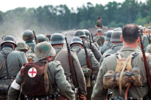
The conflict that tore through the mid 20th century happened on all multiple fronts, involving dozens of nations, territories, armies, and affecting millions of people across the world. The casualties of the war do not begin to tell the story of its effects. And yet, it was during the war efforts that nations like the United States rose to the occasion and produced great technological achievements while deploying high-level skill, craft, and expertise. The war was not just about the soldiers on the frontlines. It was about using all skills to win the war.
So what does this have to do with land surveyors? These guys played an important role in very specific frontline maneuvers.
Land Surveyors in the War Effort
An example of one of these battalions was the 16th Field Artillery Observation (FAOB) Battalion. These units were not exactly making the headlines or making the front page of the newspaper, but they were quietly playing a very important role.
Their mission was a technical one.
They were to determine the range of sound and flash in order to produce adequate counter-battery fire. These were also termed observation battalions, as most of their jobs consisted of observing and notating, then putting that information to work. There was a survey officer, which was the center of the surveying expertise of the battalion.
Where Did These Units Come From?
The officers of these units were experts in their field. The surveying experience was drawn from the Coast and Geodetic Survey, which were detailed for this task for the duration of the war during World War II. The C&GS was composed of military engineers and civilians with varying degrees of expertise in surveying, seafloor and airways charting, mapping coastlines, oceanography, and geophysics. These were expert surveyors with plenty of experience, although not necessarily in the frontline of the battle.
Most of the men in the C&GS were hardened military engineers that were used to years out in field missions attached to survey vessels. Their lifestyle was characterized by going out on a mission of mapping or surveying land that lasted for days to months to years. As the war broke out, these guys were transferred to the Navy, Army, or the Marine Corps.
What Was the Mission?
So what were these guys responsible for? To put it simply, identifying and mapping enemy fire. As these teams located the enemy fire points, they could direct counterfire.
As the American Surveyor chronicles, the ultimate goal was to tie all artillery weapons and observation systems onto a common grid to direct the “putting iron on target.” This process was highly technical and skilled in an endeavor termed Time on Target (ToT) and was grounded on the survey work performed by the surveyors.
American artillery efforts were a major force in the advancement of the infantry in all theaters of war. The ability to identify and target enemy fire was a factor in American supremacy as they advanced in both the European and Pacific theaters.
The Central Requirements for Successful Survey of Enemy Fire
The three basic requirements needed to accomplish this intricate game of precision:
- The precise location of the home team’s gun placements
- The precise identification of the target’s (enemy fire) location
- The ability to determine the azimuth of the target
This was the realm of the artillery surveyor. The azimuth in land surveying is at the center of surveying methods. It is a horizontal angle of the line when the zero is at astronomic north. The angles are measured clockwise and provide the precision needed to identify a location and strike with efficiency.
Artillery Surveyor Showing Bravery Under Fire
So while we don’t often hear of these missions that played a pivotal role in the advancement of artillery and the success in the frontlines, their accomplishments have been well recorded in the history books. One of the most famous of these surveyors was an officer called David Whipp. He was awarded the Silver Star, Legion of Merit, and the French Croix de Guerre.
While assisting the infantry in the African theater, Whipp led the survey control of artillery attack across dangerous terrain and in ‘disregard for his own safety.’ He accomplished survey control of the area quickly and despite being under heavy enemy fire.
His mission was to identify and establish survey control of an observation post. Whipp set up the surveying instruments and equipment while under fire. During this, he observed enemy fire and although not trained in artillery himself, was able to call in the points to Corps Artillery fire direction center by radio and direct fire to the enemy battery.
Whipps’ unit saw plenty of frontline action. It was recorded that the First Field Artillery Observation Battalion saw more combat than almost any other unit in the War. This meant over 900 days on the lines. Whipp went on to fight in Sicily and some of his letters home are recorded in the historical record. His letters reveal a man of profound intelligence and a soldier at heart. Some of his letters provide great insight into the role of the artillery surveyor and how they were the first ones out on the land when preparing for an attack.
A soldier and a surveyor, fighting with heart, grit, and love of the land.
Land Surveying as an Essential Tool Then and Now
The need for precise land surveying is needed just as much today.
Here at home, Land-Mark Land Surveying is part of the team that works on numerous projects and we take our responsibility very seriously. Lucky for us, we’re not under fire that often!
Want to learn more about what we do and how we could get your project off the ground? Call Land-Mark today.

